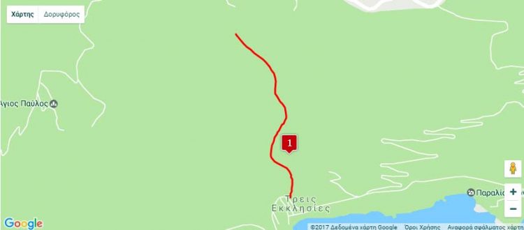
Nearest hamlet: Paranymfoi
Entrance coordinates: 034ο57.925 Ν / 025 ο 07.933 Ε / 460 el.
Exit coordinates: 034ο 57 270 Ν / 025 ο 08 161 Ε / 0 el.
Average canyon crossing time – canyoning (calculated for 4 experienced individuals): 7 h
Difficulty level (the level of difficulty is calculated on a scale of 1 to 6): 5
Longer descent: 45 μ.
Total number of descents: 22
Duration of hike from the stop point to the entrance of the gorge: 5min
Duration of the hike from the exit point of the gorge to the parking area: 0min
Entrance-exit distance (in km by car): 8.7km
Appropriate period: Year-round
Recommended period: Winter, Spring
Amenities: Ethia Information Centre and camping centre. Cafes in the villages of Paranymfoi, Ethia, Achentrias, Treis Ekklisies.
The most well known gorge in the Municipality due to its impressive 140m waterfall, the biggest recorded waterfall in Crete, which essentially receives the waters of the Amygdalos and Paranymfoi village basins.
Its name, “Abas”, comes from the Latin Abas (priest), after one of the numerous hermits who found refuge in the Asterousia in the past.
Abas is a large, beautiful and technically demanding gorge which begins at the small plateau south of the Timios Stavros peak (710m), stretches out between the Monopori (561m) and Kefala (610m) peaks and exits onto the Treis Ekklisies beach.
Traversing the gorge is difficult in terms of necessary technical skills, as it requires four aerial changes. 21 additional descents and a trekking part towards the end follow. Please avoid canyoning here from December to February, as it is the reproductive period for the birds of prey that use its precipitous rocks to nest and reproduce.
Download the kml file of the route in your device: (kml) Abas (or Mousoulis) gorge

