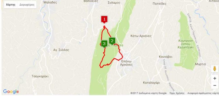
Nearest hamlet: Epano and Kato Archanes
Distance: 7.7km
Duration: 3 hours
Entrance coordinates: 35° 15.341’N / 25° 8.672’E (Anemospilia)
Exit coordinates: 35° 14.195’N / 25° 9.239’E (Epano Archanes – ring road)
Trail type: Well-trodden trail with markers
Difficulty: Moderate
Recommended season: Year-round
Amenities: In Epano Archanes
Turn right from the Archanes ring road at the sign for ‘Vasilies’. Be careful on the narrow uphill road with its many sudden turns, leading to the archaeological site of ‘Anemospilia’, where there is a small parking area. You cannot enter the fenced Anemospilia archaeological site unless you have made arrangements with the relevant archaeological service (Tel: 2810 752712 – Archaeological Collection of Archanes). The trail starting here will lead you to the peak of Mt. Juktas.
The trail follows the western slope of the anthropomorphic mountain. Shortly before the peak (approximately at the height of the telecoms antenna) you can make out the ruins of the Minoan Peak Sanctuary. Continue to the chapel of Afentis Christos [Master Christ] from where you can enjoy the panoramic view of the entire region of Heraklion. This is the starting point of the second trail, downhill all the way, following the eastern side of Mt. Juktas, which ends at the Archanes ring road (at the ‘Afentis Christos’ sign). Please note that you must have taken care of leaving a car at the finishing point, as the starting and finishing points are some distance from each other, and will take you more than an hour’s hike on asphalt to get from one to the other.
Download the kml file of the route in your device: (kml) Anemospilia – Mt. Juktas – Archanes
source: archanes-asterousia.gr

