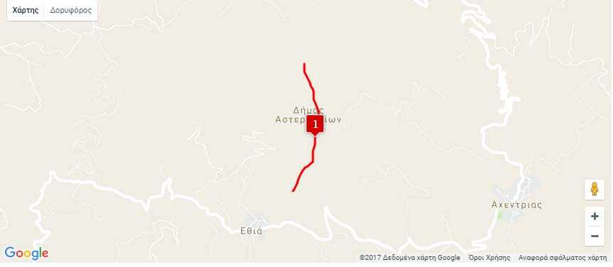
Nearest hamlet: Ethia
Entrance coordinates: 034ο59.512 Ν / 025 ο 11.834 Ε / 670 el.
Exit coordinates: 035ο 00 559 Ν / 025 ο 11 839 Ε / 282 el.
Average canyon crossing time – canyoning (calculated for 4 experienced individuals): 3,5 h
Difficulty level (the level of difficulty is calculated on a scale of 1 to 6): 3
Longer descent: 37m
Duration of hike from the stop point to the entrance of the gorge: 5min
Duration of the hike from the exit point of the gorge to the parking area: 0min
Entrance-exit distance (in km by car): 10.8km
Appropriate period: Year-round
Recommended period: Winter, Spring
Amenities: Ethia Information Centre and Camping Centre. Cafes and taverns in Ethia.
After stopping at the Ethia Visitors’ Information Centre where you will learn about the Protected Area of Asterousia, continue towards the Vorno (or Ethia, or Chavga) Gorge, the largest gorge on the northern side of Asterousia. The typical limestone rocks, some of which are crumbling, are clearly visible above, so you need to be very careful of landslides. From the entrance to the gorge the rising of Asfentilia is visible, where scientists from the Natural History Museum of Crete have located rare fossils, which will be studied to contribute significant new data on the paleontological history of the island. Water only crosses this gorge after heavy storms. It is generally open and features a long hiking path at its exit, meeting the Anapodaris River, which waters the large valley of Mesara. The gorge can be also crossed on foot.
Download the kml file of the route in your device: (kml) Chavga – Vorno gorge
source: archanes-asterousia.gr